With the big race coming up fairly soon, I decided I need to put in some time on the course.
Part of me likes the unknown and the excitement of adventure, and part of me likes to not get lost during the race, know where the aid stations are, and generally make the 120 miles as painless as 120 miles can be. Someone said “Adventure is poor planning” anyway.
So I kennelled the dogs first thing in the morn’ and drove out to the very start of the race, which is furthest to the East, in a park called Cathedral Park (NO DOGS ALLOWED, fuck you Cathedral park).

A park that doesn’t allow dogs is dead, to me.
It’s easy as hell to get to the start, thankfully. I hop out of my truck, and first thing’s first I need to purify like 10 L of water. Damnit, why didn’t I fill these bottles at home? Finally, I gear up, sunscreen up, and off I go.
Though the GPS routes exist online, I never did manage to get them onto my Garmin, so I’m running blind. Thankfully, and very surprisingly, the whole thing is marked for race day already!

Those pink ribbons are so comforting, out there.
You start off this bridge and then right away start climbing. Lakeview Trail. Beautiful. The hill is steep-ish. It’s actually kinda like Hope Pass in Leadville. Damn near runnable the entire way, but steep enough that you wouldn’t. Or at least, I wouldn’t. I guess the real superstars would.
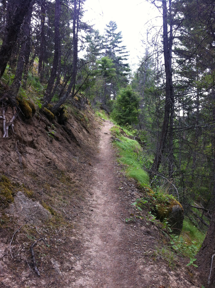
It was dead easy to follow the trail, but … it was perfectly marked the whole time, so perhaps that’s not a fair statement for not-race-day days. Basically you cross the road a few times but I think you’d be pretty hard-pressed to get lost, since there’s only one trail.
Blah blah running running. Super scary dark woods, middle of nowhere, blah blah bears. Blah Blah very nice trail, continuously climbing, from what I can recall, but again, that irritating incline that’s just too steep to run but shallow enough that you think about it the whole time. I walked all the uphills, knowing full well that walking is the way to go on race day, and I wanted a reasonable approximation of my race pace.

I love grass.
Finally you get past all the scary bear sections and you emerge into these beautiful meadows of beautiful flowers, and you think “My God, this is beautiful!” Then you actually are thrust back into the scary bear woods and have to do more running. Damnit.

Beautiful! But short-lived.

Ok great, this doesn’t look scary at all, I’m sure being out here alone is totally cool.

JESUS CHRIST DID A BEAR DO THAT?!
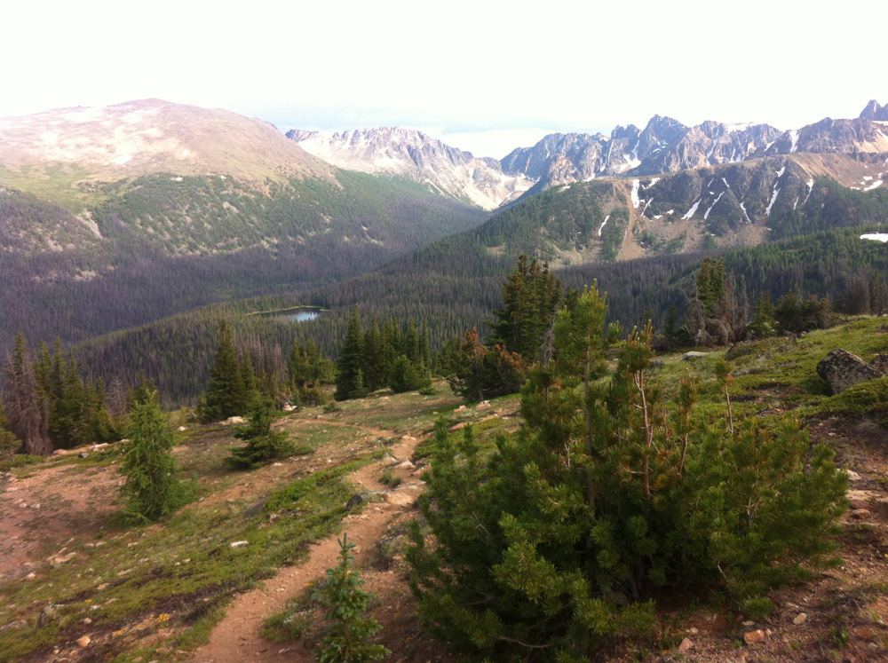
Finally, finally you break out into the real sub-alpine (or is it just alpine? What am I, a forester?) and you can sense the summit nearby. Pace gets faster and motivation gets upper.

It was at this point that the flagging ran out, although I didn’t realize it at the time. I turned right, headed up the switchbacks, and scared the living daylights out of some poor hiker! “Movement!” she says. Hilarious. Then she asked me “how much further?” and I replied “13 km”. And the look on her face. My god, I thought she was honestly going to cry. And she looked at her friend like “Oh. Shit.” and then said “You’ve got to be kidding…” and I said “13.29, exactly.” and then she realized she wasn’t going to where I came from, she was going back to the lodge which was about 1 km away. Lucky her.
I kept going, and shortly thereafter emerged on the mountain peak! Then I hit the signpost. “Rim Trail | Centennial Trail”, arrows pointing everywhere. I got confused. I realized I hadn’t seen a trail marker in ages. So I ran back down, and realized, no, wait, that was the right way! So then I ran back up!! However I only got 50 % of the way up when I realized oh, shit, it’s getting super late, and those scary bear woods were scary enough in the daylight!

I should have studied harder.

Mountain views!
So I turned around and hauled ass back to the truck. Damn, it was scary.
All in all it took me about 2:28 to get to the intersection, which is where the Cathedral Aid Station will be, which was 13.17 km in. The race guide says 12 km to the Cathedral station. The course record holder (27 hrs, Hassan Lotfi-Pour) made it to this station in 1:45, and the 2nd place winner (33.5 hrs, Nicola Gildersleeve) got to this station in 2:17. I’ll be aiming for 2:15, I think. No need to try to catch up to the out-of-the-gate sprinters.
It took me 1:39 to get back down those 13 km. If I extrapolate that to the 17 km on the other side, to Ashnola River Road, that would be a 2:09 descent. Hassan’s split was 1:38 (5:11 pace!) and Nicola’s was 1:54 (6:42 pace). From what descending I did for the rest of my recon runs, 6:40 pace seems pretty bang-on for a nice descent, but we’ll see how fast the trail is, on race day.
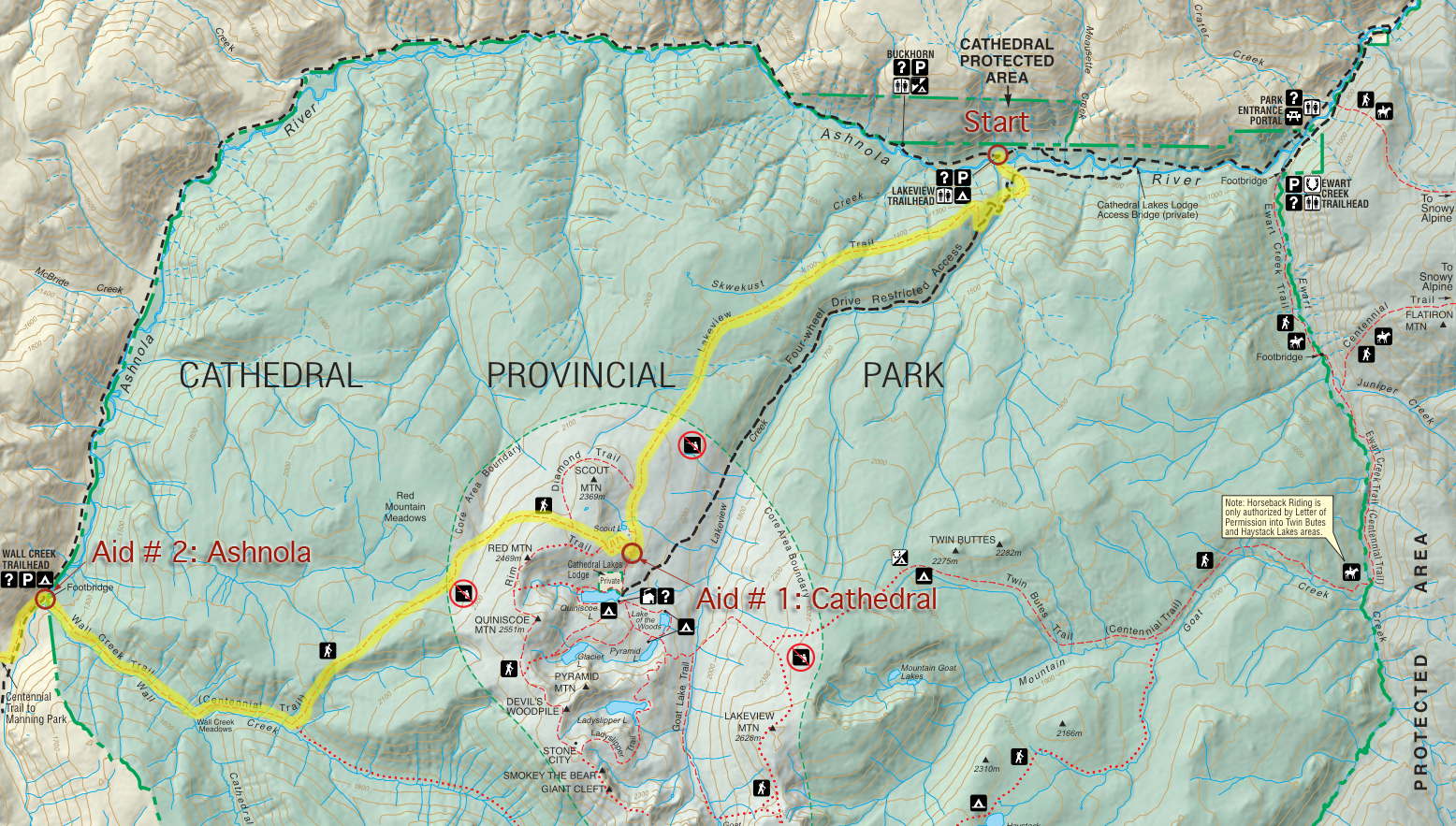
Here is the route, drawn onto the park map, if you want to actually learn where to go:
Looks easy, from up here!
After running, I washed in the river (beautiful!) then drove into Keremeos for some acclaimed Thai food at “Benja”. It was ok, and cost about a million dollars, but certainly had to be the best food in Keremeos! That night I slept in the back of my truck. It was hot, uncomfortable, and I didn’t have a pillow, so my neck was killing me. It was also insanely loud (how could anyone camp near the river?!) and so at 1 (or was it 3?) AM I got in the cab and moved the truck to a new location. I love having a vehicle I can sleep in, but a Ranger? Too small.

Campsite. I need a bigger truck!!
The next day I would awaken and check out Leg 2: Trapper Lake.
Leave a Reply