Woke up feeling like dogshit after a crappy sleep in the Ranger (although, could certainly have been worse. I just need a) Pillow, b) summer sleeping bag.)
Drove for what felt like forever along this dirt roads, while trying not to slide off into the ravine. Eventually got to the second aid station, called “Ashnola River Road”. Which makes sense, because that’s the road I was on.
At this point in the race, the runner will have run up from the road, up Lakeview to the top of Cathedral Park, and then all the way back down to the same road, just, a long way to the South-West. They will have run about 29 km, in roughly 4-5 hours.
Here I was getting ready for another long day on the trails when a forest ranger type guy showed up. I chatted with him a tiny bit, then thought “I should tell him where I’m going.” Isn’t that a rule of mountain safety? Let someone know where you’re going? So I said “I’m actually headed up Trapper Lake way… you know, in case I die, you won’t go looking for my body up on Centennial” and he immediately without even looking at me says “Oh I wouldn’t anyway.”
Alright, well thanks buddy.
So I gathered my gels and shit and off I went.
The beginning is dead flat on the road, slightly annoying and loose but not too bad. Only about 1 mile, from what I can tell. Then you head West again, straight up this steep sandy slope. You quickly hit a switch back section, and it’s a bit on the overgrown side, but overall not unenjoyable. Even at like 7 AM the sun was blazing and it was cooking hot. I guess on race day we’ll be hitting this section at 2 to 3 PM, so it’ll be hot.
More beautiful trail!
The trail had enough old markers on it that it was pretty easy to follow, although I don’t think there was anywhere to really get lost, at this point. Some sections are pretty overgrown though.
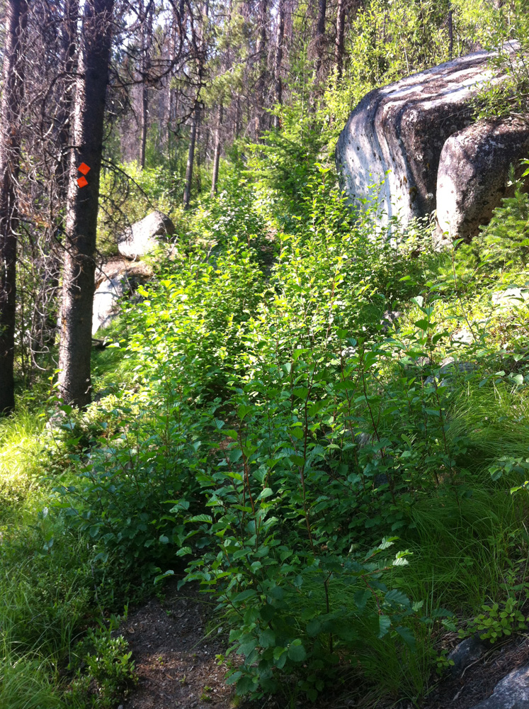
At least there’s markers on the trees!
After a while (can’t remember much, honestly) you hit the burned out forest section. On Google Maps satellite view, which is what I would call the “wide swath of logged shit”, but on the trail it was actually pretty neat. A bit tough to run, because the ground is covered in plants and the trail is barely visible, but not too steep. You would be hooped without the trail markers that have been left behind over the years, but in general you just keep heading due West.
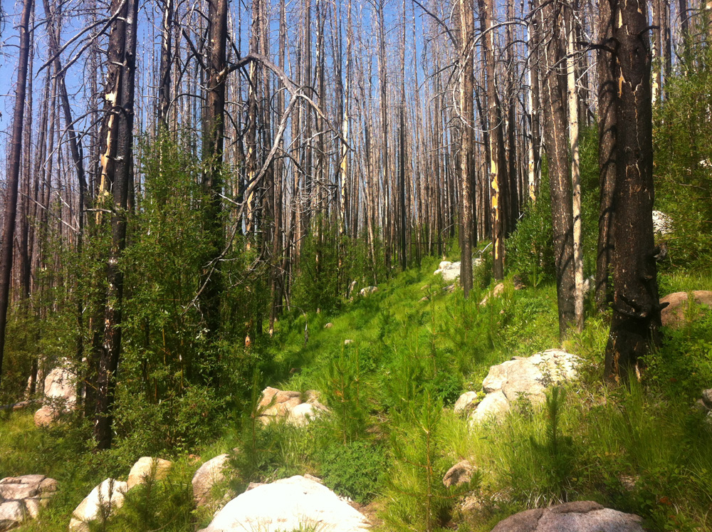
Burned out section is pretty neat.
Finally you pop out at a logging road with a little sign and an outhouse. This is where the aid station will be. According to the Garminator this took me 1:25 for about 7.4 km (7 km in the race guide). This apparently took 1:08 for Hassan and 1:26 for Nicola, so I’m happy with that split. I took photos, got lost, etc, so it’s a very reasonable time.
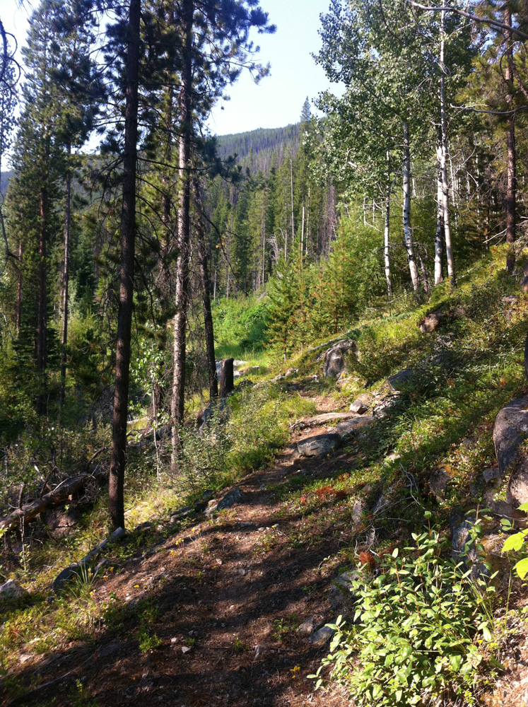
From here the course starts to become normal forest, and you get really enjoyable. The steepness is runnable, from what I can recall, and the trail is great. You finally pop out at the lake, where I briefly missed a left-hand turn. I knew I was supposed to be South of the lake though, so it’s an easy fix.
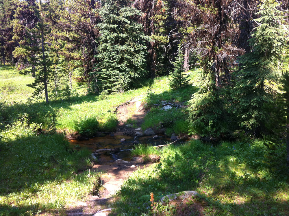
Perfect forest trails! Perfect!
Unfortunately, here the trail went dead. The South-East end of the lake is this giant swampy grass patch, and there we no markers anywhere. I spent a lot of time running (well, trudging) back and forth, sweeping the edge of the woods for a marker, shin deep in water and muck.

Very wet, but kinda refreshing at the same time.
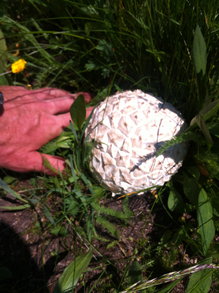
Look at this crazy huge mushroom!

Big freakin’ Mule Deer(?) tracks.
Finally I found a marker, and sped off, but it didn’t feel right: I was headed nearly South, and I figured I should be going North, or at least North-West. I was also going downhill, which is the worst when you know you’ll have to turn around! So I stopped and turned back. I tried another route, no good. Tried another route, and this one was ok. I was headed in the right direction, anyway. Later I’d find out I still wasn’t on course, but it was close enough.
After another little foresty section with some ups and down, you emerge into this really big, open meadow, and it’s fantastic. There’s no sign of the trail anywhere, so I just kinda marched to the North-West.

Feel free to run in whichever direction you prefer!
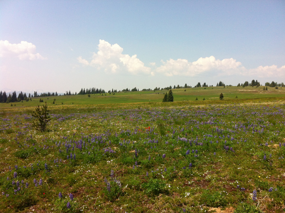
More pretty flowers.
Here is when I realized that my Garmin was going to run out of batteries.
Now the Garmin 310xt has this cool feature called “Back-to-Start”, which draws a little mini-map for you, so you can find your way home, even if, for example, you are in the middle of nowhere with no idea where you came from, or you have to run back through a burned out forest-maze in the dark, while being hunted by cougars.
So to lose this feature would be not a positive thing. So I was thinking “I really should have charged my Garmin after that last 5 hour run…” and “Fuck I should turn back,” but first I had to run to the top of Flattop Mountain! So I booked it up to the summit, while a chopper flew by a couple times overhead. I can imagine him thinking “WTF is this guy doing out here all alone wear those little shorts?”
So I reached the top, took some pictures, and then ran the entire way back home, sans-stopping. Took me about 4 hours to get to the top (of course, I did get lost) and only 2:15 or so to get down. Very nice, runnable terrain the whole way down, so it was really chill. Was fun.

View (East?) from the top of Flattop Mountain.

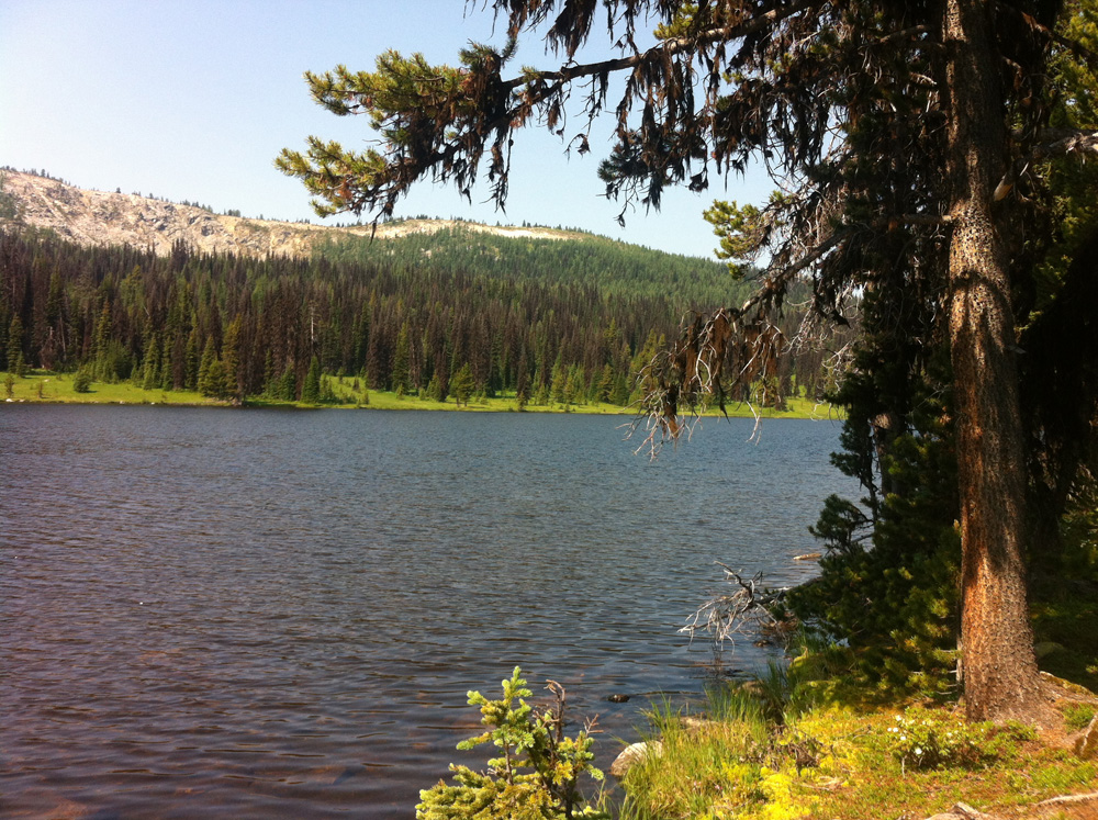
One last shot of the lake, as I ran home.
I got back before the Garmin died, packed my shit, and drove to Princeton, where I rented a room in the Sandman, ate some steak dinner, and then rewarded (punished?) myself for a fantastic run with about 8 lbs of ice cream. My god I love ice cream.

Butter Pecan, Chocolate Chip Cookie Dough, and some caramel kind.
The next day would bring another recon mission up Leg 3: Bonnevier.